
價格:免費
更新日期:2020-08-03
檔案大小:166 MB
目前版本:1.3
版本需求:系統需求:iOS 9.0 或以後版本。相容裝置:iPhone、iPad、iPod touch。
支援語言:英語

[DESCRIPTION]
Achilleus 3D is a Tactical Map and Navigation tool, designed to maximize situational awareness and operational readiness.
Plan and organize your mission!
Features
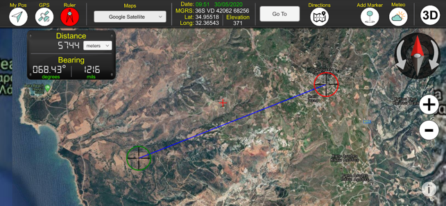
[MAPPING]
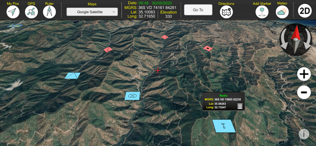
- 2D maps and 3D maps with elevation.
- Online and Offline Maps (Virtual Earth, Google Satellite, OpenTopo, OpenStreetMap, ArcGIS Satellite, Nokia).
- Automatically cache Map and Elevation data and can be used when you are offline.
- Military Grid Reference System (MGRS) & United States National Grid (USNG).
- Latitude/Longitude degrees.
- Create and navigate to waypoints.
- Use the crosshair to position new waypoints.
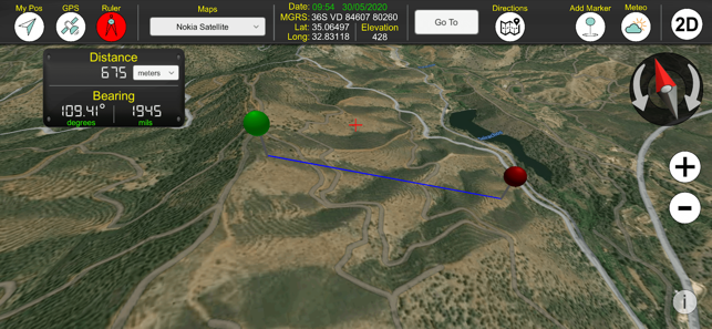
- Measure distances.
- Measure bearings (mils, degrees).
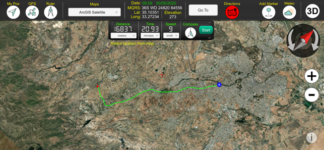
[NAVIGATION]
- 2D and 3D Navigation. Draw your route to destination.
- Use compass to rotate map, while you travel.
- Get speed, total distance and time to destination.
- GPS current location and altitude in real time.
[MILITARY SYMBOLOGY]
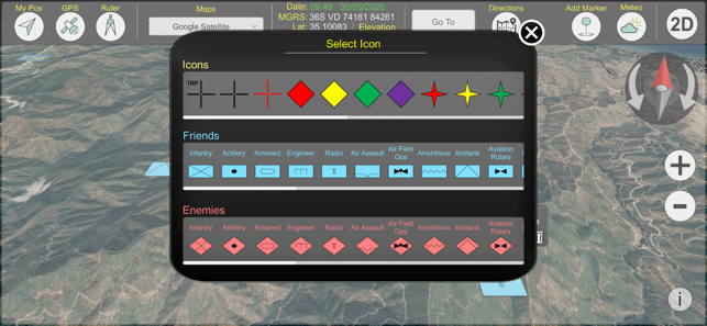
- Includes basic Joint Military Symbology (MIL-STD-2525D/APP6X).
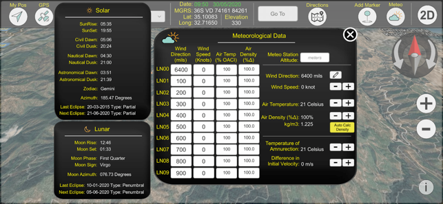
[SOLAR & LUNAR INFORMATION]
- Wide array of location based Solar/Lunar information such as Rise/Set times, phase info and more (works offline).
[USER INTERFACE]
- All info is displayed in large, clear text for easy viewing at all times.
- Simple, intuitive interface that can be operated easily with one hand.
NOTE: Using GPS will shorten battery life.
支援平台:iPhone, iPad